- Products ProductsLocation Services
Solve complex location problems from geofencing to custom routing
PlatformCloud environments for location-centric solution development, data exchange and visualization
Tracking & PositioningFast and accurate tracking and positioning of people and devices, indoors or outdoors
APIs & SDKsEasy to use, scaleable and flexible tools to get going quickly
Developer EcosystemsAccess Location Services on your favorite developer platform ecosystem
- Documentation DocumentationOverview OverviewServices ServicesApplications ApplicationsDevelopment Enablers Development EnablersContent ContentHERE Studio HERE StudioHERE Workspace HERE WorkspaceHERE Marketplace HERE MarketplacePlatform Foundation and Policy Documents Platform Foundation and Policy Documents
- Pricing
- Resources ResourcesTutorials TutorialsExamples ExamplesBlog & Release Announcements Blog & Release AnnouncementsChangelog ChangelogDeveloper Newsletter Developer NewsletterKnowledge Base Knowledge BaseFeature List Feature ListSupport Plans Support PlansSystem Status System StatusLocation Services Coverage Information Location Services Coverage InformationSample Map Data for Students Sample Map Data for Students
- Help
Get Started
This section shows how to start using the HERE Maps API for JavaScript with a basic use case.
Use Case
The use case is to create an application that displays a default map, which is non-interactive.
Its implementation uses JavaScript code to display the map in an HTML page and consists of the following steps:
- Load the Maps API code libraries.
- Initialize communication with HERE back-end services (to request map image tiles).
- Initialize a map object, displaying the map.
Below, we explain these steps in detail.
Load the API Code Libraries
The first step for any application based on the HERE Maps API for JavaScript is to load the necessary code libraries or modules. The implementation of our basic use case requires two modules: core and service (see also HERE Maps API for JavaScript Modules).
To load the modules, add the following <script> elements to the <head> of the HTML document:
<script src="https://js.api.here.com/v3/3.1/mapsjs-core.js"
  type="text/javascript" charset="utf-8"></script>
<script src="https://js.api.here.com/v3/3.1/mapsjs-service.js"
  type="text/javascript" charset="utf-8"></script>
The URL in the "src" attribute contains a version number that reflects the latest major release of the API. Note that this version number changes with each new release, which may break backwards-compatibility – for more information, see API versions.
Alternatively the API can be loaded as an EcmaScript 6 module:
<script type="module" src="https://js.api.here.com/v3/3.1/mapsjs.bundle.js"></script>
The above mentioned bundle contains all major parts of the API:
corecore-legacyserviceservice-legacymapeventsuiclusteringdata
To ensure optimum performance on mobile devices, add the following meta-tag to the <head> section of the HTML page:
<meta name="viewport" content="initial-scale=1.0, width=device-width" />
Here is the complete <head> element that loads the core and service modules and ensures optimum performance on mobile devices.
<!DOCTYPE html>
  <html>
    <head>
      ...
      <meta name="viewport" content="initial-scale=1.0,
        width=device-width" />
      <script src="https://js.api.here.com/v3/3.1/mapsjs-core.js"
        type="text/javascript" charset="utf-8"></script>
      <script src="https://js.api.here.com/v3/3.1/mapsjs-service.js"
        type="text/javascript" charset="utf-8"></script>
      ...
    </head>
    <body>
      <div style="width: 640px; height: 480px" id="mapContainer"></div>
Initialize Communication with Back-End Services
An essential part of creating a working application with the HERE Maps API for JavaScript is to establish communication with the back-end services provided by HERE REST APIs. In our scenario, the back-end services process requests for the map data and delivers it to the application for display.
For this purpose, initialize a Platform object with the apikey you received on registration (see Acquire Credentials):
var platform = new H.service.Platform({
  'apikey': '{YOUR_API_KEY}'
});
Furthermore, the object provides methods that allow for easy creation of fully working service stubs, such as map tile service stubs, routing service stubs, and the like.
Initialize the Map
The application in our scenario is to display a non-interactive map centered on a predefined location at a fixed zoom level. To implement this:
- Create an HTML container element in which the map can be rendered (for example, a
div). - Instantiate an
H.Mapobject, specifying:- the map container element
- the map type to use
- the zoom level at which to display the map
- the geographic coordinates of the point on which to center the map
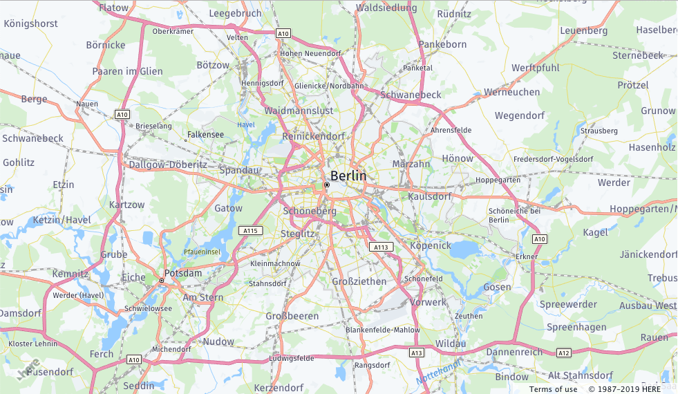
The implemenation JavaScript code shown below sets up a Map object, specifying the normal map type, zoom level 10, and the map center as a location near Berlin, Germany, given by latitude 52.5 and longitude 13.4:
// Obtain the default map types from the platform object:
var defaultLayers = platform.createDefaultLayers();

// Instantiate (and display) a map object:
var map = new H.Map(
    document.getElementById('mapContainer'),
    defaultLayers.vector.normal.map,
    {
      zoom: 10,
      center: { lat: 52.5, lng: 13.4 }
    });
The implementation displays the following map image:
The following section shows the solution including the complete HTML code of the page.
Complete HTML Example Page
Below, you can find the complete source code that implements the basic scenario:
<html>
  <head>
    <meta name="viewport" content="initial-scale=1.0, width=device-width" />
    <script src="https://js.api.here.com/v3/3.1/mapsjs-core.js"
    type="text/javascript" charset="utf-8"></script>
    <script src="https://js.api.here.com/v3/3.1/mapsjs-service.js"
    type="text/javascript" charset="utf-8"></script>
  </head>
  <body>
    <div style="width: 640px; height: 480px" id="mapContainer"></div>
    <script>
      // Initialize the platform object:
      var platform = new H.service.Platform({
        'apikey': '{YOUR_API_KEY}'
      });

      // Obtain the default map types from the platform object
      var maptypes = platform.createDefaultLayers();

      // Instantiate (and display) a map object:
      var map = new H.Map(
        document.getElementById('mapContainer'),
        maptypes.vector.normal.map,
        {
          zoom: 10,
          center: { lng: 13.4, lat: 52.51 }
        });
    </script>
  </body>
</html>